Chiricahua Mtns.
Heather celebrated her 32nd birthday last weekend (all weekend, as she is wont to do) and in grand fashion she wisked Maxine and me away to the mountains she'd not seen since she was a child. The Chiricahuas are famous around here for two things: the national monument enveloping the Heart of Rocks area, and the last stand of the Chiricahua Apaches, led by Geronimo. We steered clear of the monument - a magnet for sightseers and motorhomes - and found our own campsite on the south side. After a slow first evening settling in to our campsite, a toasty fire, and good conversation, we hit the trails on day two.
 Heather transcended her usual slow rhythms and worked up a sweat (and eventually some sore muscles) on our uphill hike. It's not often that one is struck by lush green valleys in this area.
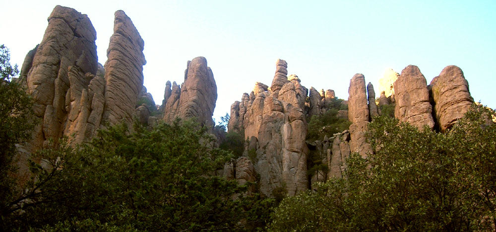
 A dirt road bisects these mountains and offers sweeping views of the cliffs and valleys south of the monument. Mental note: Maxine hates dirt roads. Before heading back to Tucson we had to check out the monument, so we drove the spotless, paved road that goes all the way to the top. The Heart of Rocks is reminiscent of the rock formations in southern Utah - tall spires, rounded by wind and rain. This is a truly spectacular sight and I swear I'll be back to explore it on foot.
 At the top...
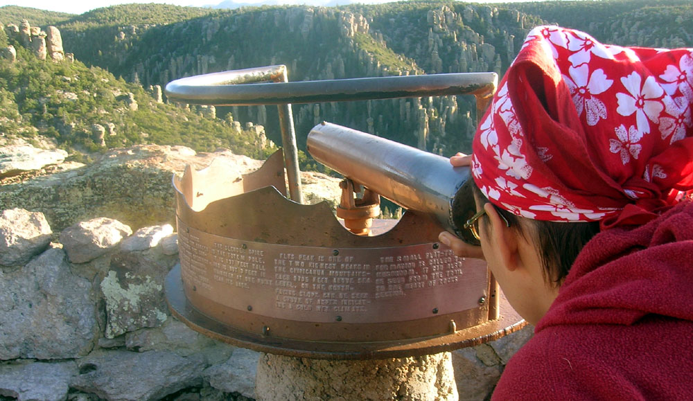
 Although it looks like a telescope, this gizmo is more akin to a paper towel tube with crosshairs at the end. As it spins around and rests in the depressions you can look to the text beneath it for descriptions of what you are supposed to see in your crosshairs.
 See how marvelous!
 What I'll remember most about this trip is the 6" thick foam sleeping pad we borrowed from Heather's dad. It was more comfortable than my bed. Did I mention it was in the 70s during the day and couldn't have been below 45 at night?
This entry was posted by Jeff, on
Wednesday, January 18, 2006.
You can leave your response.
![]()
![]()